South Fork of the Matanuska
Published:
Context
Shortly after my fiancée, Mary, made plans to spend a summer in Palmer working as a public defender, I booked flights to visit her for the last two weeks of her stay. We both planned to take the second week completely off from work and head out on some Alaskan adventures. As I began researching, I found Luc Mehl’s write-up of his traverse across the Brooks Range. We did not have the time or experience for such an epic route, but a packrafting trip—if the weather cooperated—was in the cards. We had two constraints:
- The whitewater could not exceed Class II. This would be our first time packrafting and our first time on rivers in Alaska. While Mary and I have both spent time on Class III whitewater in kayaks and canoes, this trip already had enough variables without adding more whitewater risk.
- The trip needed to be reasonably accessible from Palmer, Alaska, where Mary was living. With only a week to work with, we did not want to spend too much time driving or flying.
With these two constraints, I found this route on Luc’s website. He described it as “a candidate for the best true packraft loop around, especially during the autumn.”
The best true packraft loop in autumn sounded pretty good to me. Our early-September dates lined up well for fall colors and lower water levels. Now we just had to hope for good weather.
Once I arrived in Alaska, we began filling in the details. Before the packrafting trip, we made plans to fish on the Kenai River with some of Mary’s coworkers. On our way back through Anchorage on Tuesday, September 1, we would rent packrafts and dry suits from The Hoarding Marmot and return them right before we flew out on Sunday, September 6. That gave us four days, Wednesday through Saturday, to complete the loop.
As the trip approached, the forecast made our decision clear: Wednesday through Friday would be mostly clear, and Saturday would be rainy. So we would start hiking Wednesday morning and plan to exit Friday.
Our friend Nahla had packrafted this route the previous year and offered the following beta:
There’s one spot where there’s a really specific descent down this cliffside, and if you don’t find it, it looks really, really impossible. There is a lot of bushwhacking, and I think the way that we went was not the most optimal way, so I’d recommend a different way. Those are the two main things, and then just knowing and being prepared for the water—it is continuous Class II, so it’s not intense, but for my friend it was a little intimidating just because it does feel like if you were to flip, it would be really easy to float downriver. Dry suits are absolutely necessary. That’s pretty much it. We saw a lot of bear scat, but no bears, no moose. Yeah, it was incredible, truly.
Nahla was kind enough to send us her GPX file, which provided slightly more detail than the route Luc had marked on Google Maps.
Day 1
We anticipated that the weather might begin to deteriorate Friday afternoon, and the trip involved a fair amount of uncertainty, so we decided to get an early start Wednesday. I set my alarm for 4:45 a.m. We departed Palmer at about 5:15 and drove most of the way to the Lionhead Trailhead in the dark.
It was light by the time we reached the trailhead. From there, we had about a three-quarter-mile walk to Caribou Creek. We began inflating our boats for the second time (the first was at The Hoarding Marmot the previous afternoon). I was immediately concerned that the valve on my packraft did not seem to operate correctly as a one-way valve, despite being turned in the “left” direction. However, after a brief consultation with the web (we still had service), we learned that Alpacka Raft does not intend its valves to be perfectly one-way. Air stops flowing out only once the boat is fully inflated and the cap is tightened.
With added confidence from this discovery, we finished inflating the packrafts. I was using the Classic model, while Mary was in a Gnarwhal. The Gnarwhal includes a zipper that allows gear to be stored inside the packraft tubes. Very clever! The Classic does not have that feature, so I gave Mary most of my stuff and kept my backpack between my legs.
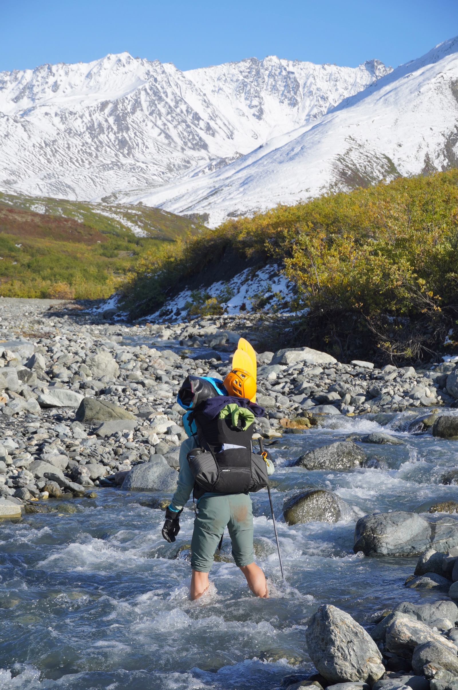
The first packraft section was about a mile and involved floating down Caribou Creek to its confluence with the Matanuska, then taking out on the far side of the river. We put in just as the first rays of sun hit the water. Packrafting turned out to be pretty straightforward. When we took out on river left of the Matanuska, the air temperature must have been below freezing because ice formed on our boats and gear as we packed up. The trail toward Spoon Valley was initially pretty good, but it eventually disappeared. Nahla’s track hugged the creek, but in the interest of keeping our feet dry, we stayed farther right and ended up with some bushwhacking and extra climbing that may or may not have been better than getting our feet wet.
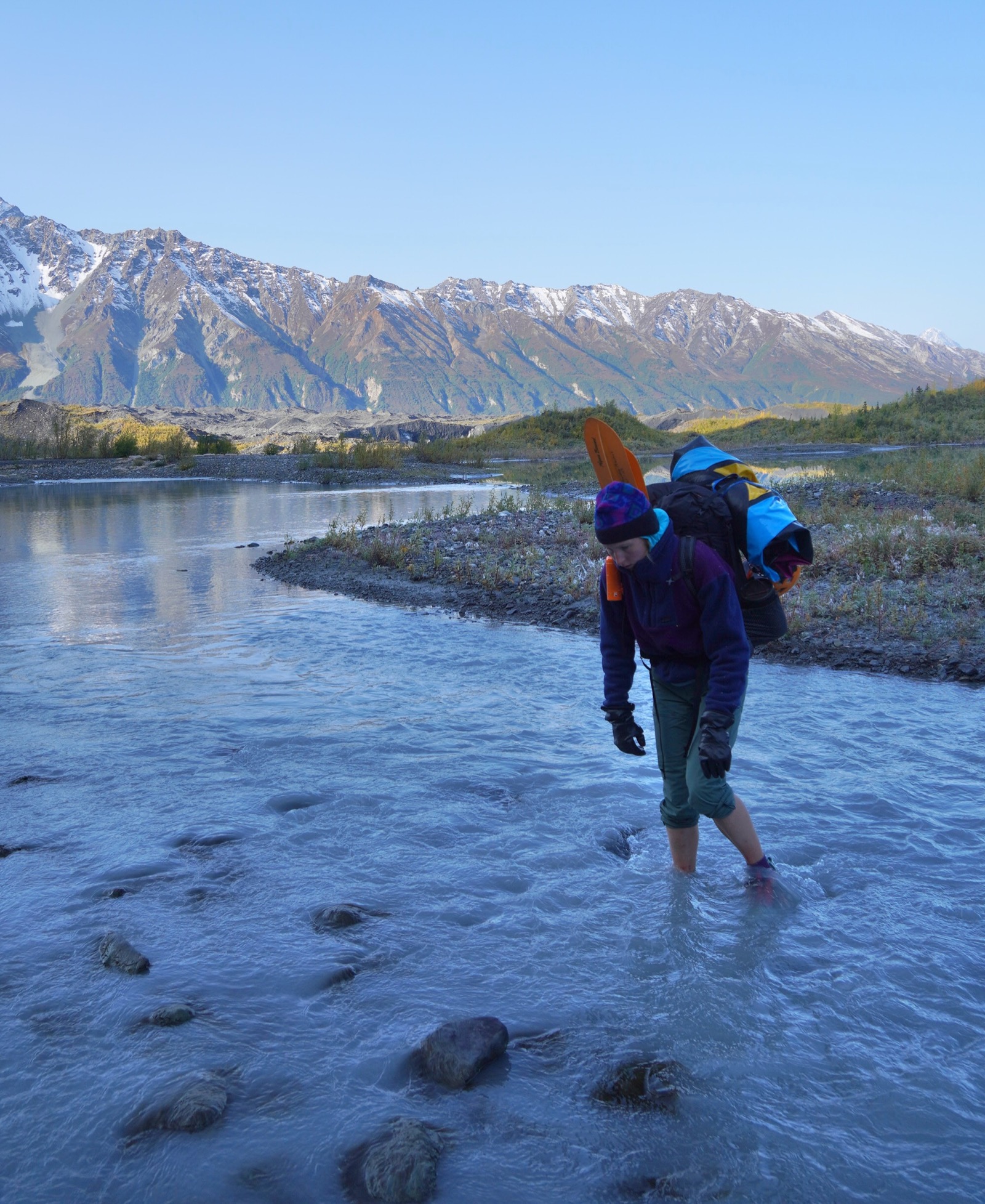 Mary crosses the creek flowing out of Matanuska Glacier.
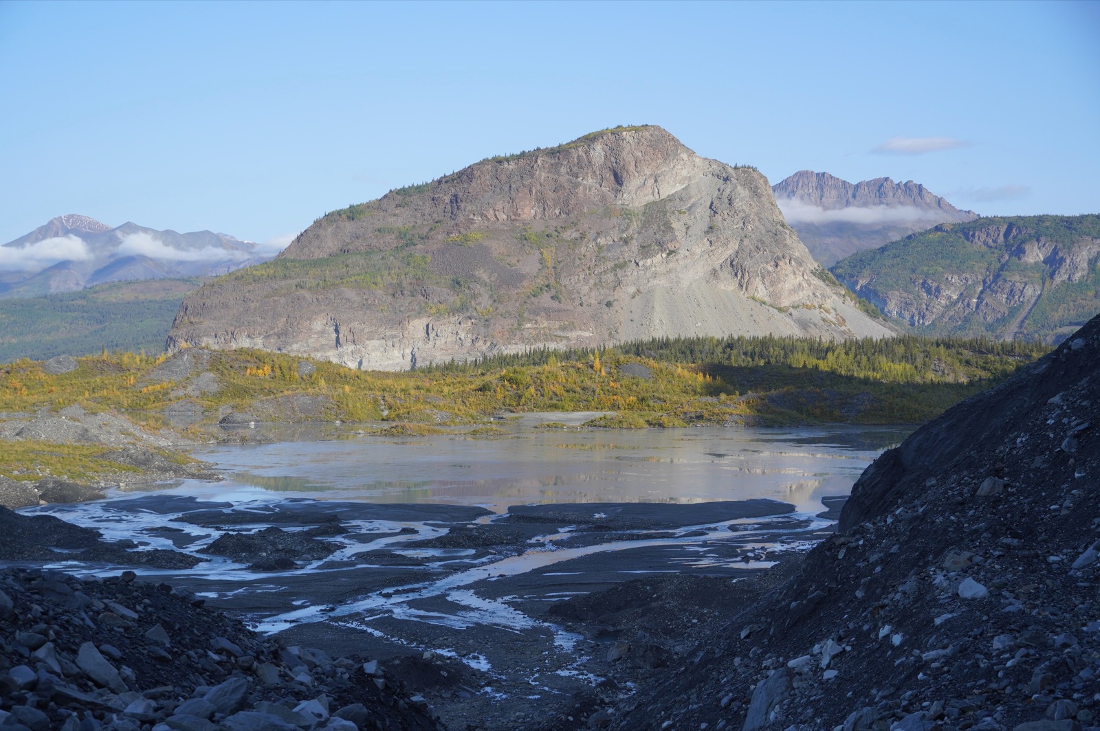 Once we made it to the toe of the glacier, we were rewarded with nice views back toward Lion’s Head.
We stayed as far left, against the cliff, as possible while heading farther up Spoon Valley. The first crux was a narrow creek section with a series of cascading falls. It was still early enough that the rocks above the waterline had a sheen of ice, making everything very slippery. We had to cross the creek below one waterfall and above another. The crossing itself was simple enough, and the water was never more than a foot deep, but the consequences—getting washed down the lower falls—felt a bit dire. I went first and found the footing below the waterline pretty decent. I ferried both packs across, and then Mary followed. There were no additional challenging moves as we climbed the canyon, but even with dry suits, our feet became reasonably cold.
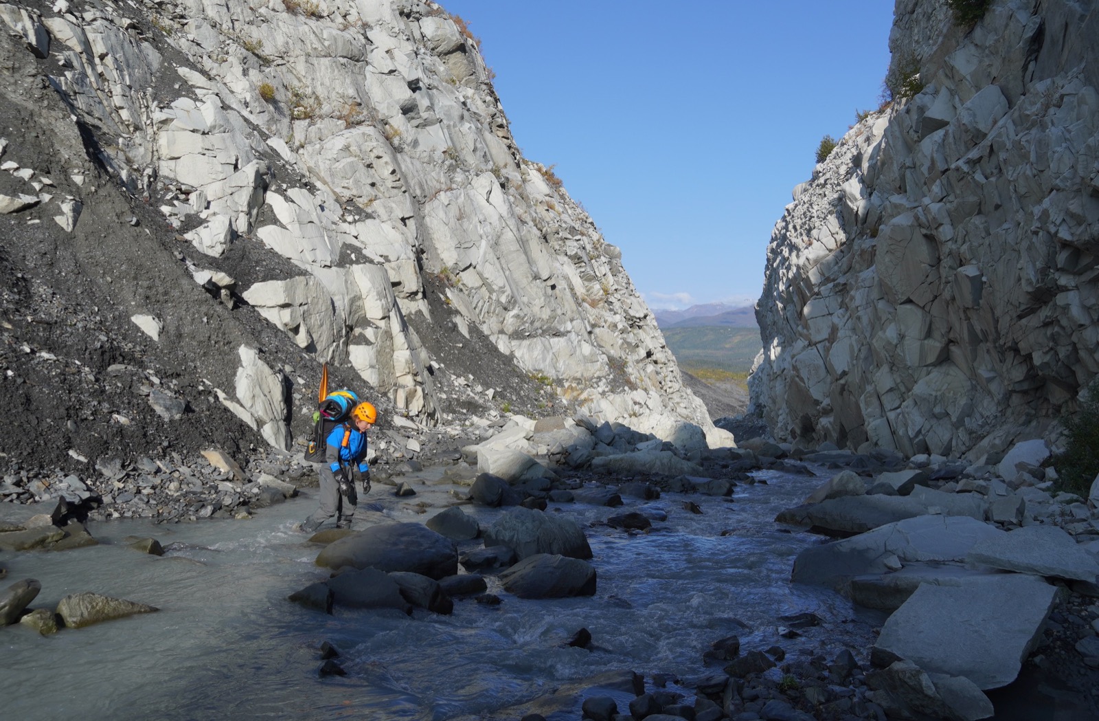 Chilly!
Once out of the canyon, we stopped to warm up in the sun and eat a snack. Would we continue walking in creek beds all the way up Spoon Valley?
As we approached the next side canyon, I could see from a distance that it was dry, with no water running through it. Happy days!
From there, we had an easy walk up the rest of the valley. The colors were beginning to change, and the gradient was gentle.
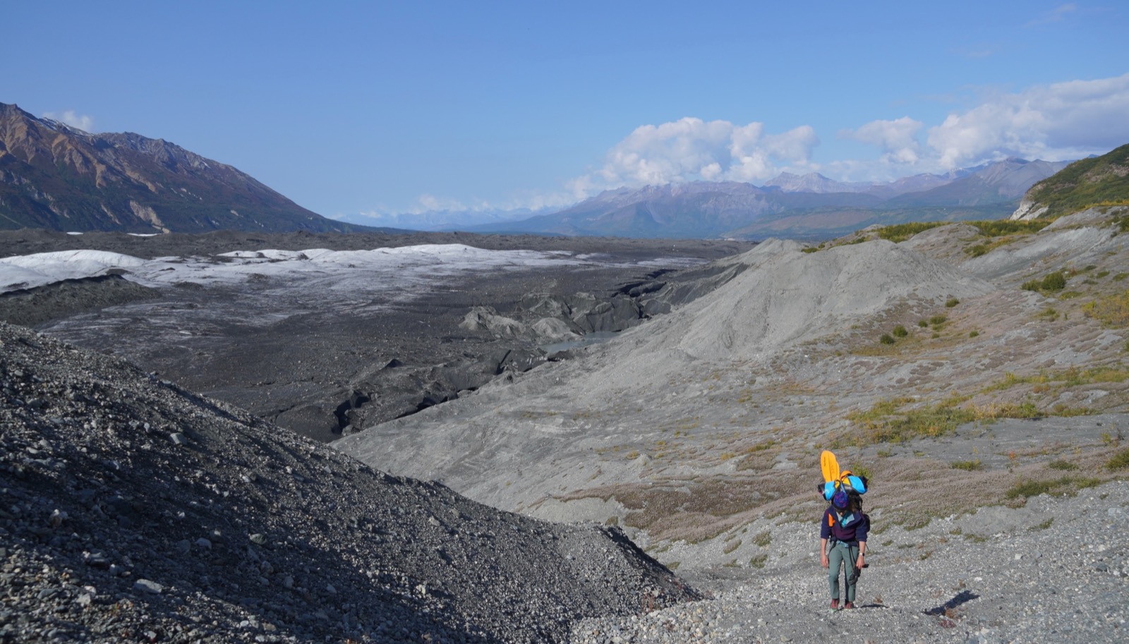 The lower sections of Matanuska Glacier could benefit from a wash.
Reviewing Nahla’s map, we concluded that the next crux would be descending from Spoon Valley into the side valley we needed to hike up.
Indeed, that was the case. The route Nahla took appeared to be a cliff. Perhaps closer inspection would have revealed a viable route, but we decided instead to continue climbing and descend a gentler slope.
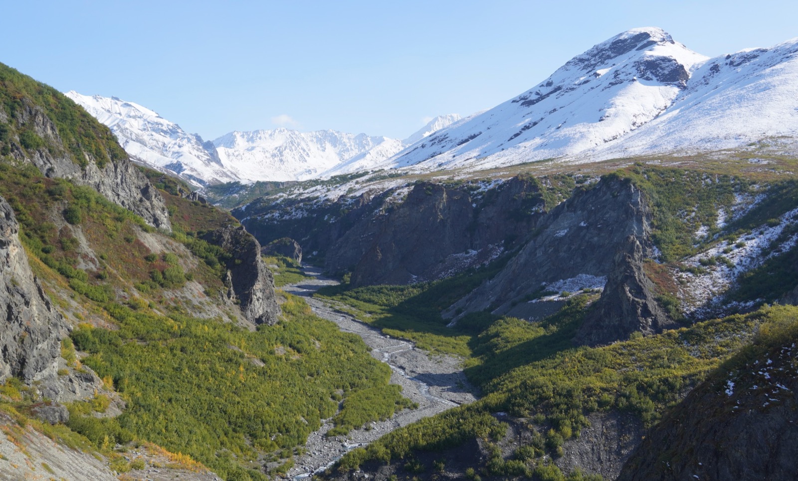 Looking down into the valley we hoped to ascend. So close and yet so far away.
We ultimately found a decent trail down that slope but spent about 1.5 hours covering less than a mile.
We decided to walk another four miles or so, until the route branched away from our current river valley, and camp there. Those four miles went by pretty quickly. We crossed the river a handful of times, but the warmer air made getting our feet wet far less unpleasant than it had been that morning.
We reached our campsite shortly before 7 p.m., pitched the tent, organized our gear, and ate burritos purchased from the only Mexican restaurant in Palmer (not Taco Bell this time). We then carried our food some distance from camp, put it in a bear can, stashed it in a bush, and got into the tent.
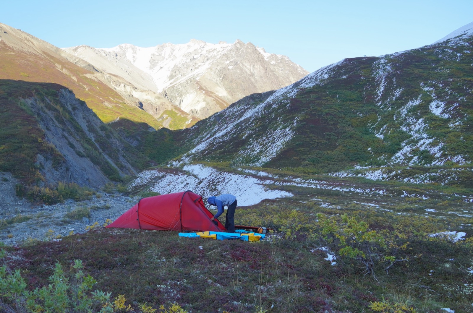 Camp 1.
Temperatures dropped quickly once the sun went down—maybe from cold air blowing off the glacier at the head of the valley. I was very happy to have brought a 0-degree Marmot bag that I had recently inherited from my dad. Mary was in a 15-degree bag, but with a sleeping bag liner and additional layers, she also claimed to be sufficiently warm.
Mary set her alarm for 6:30 a.m. (my watch was already dead after attempting to record our 12-hour hike), and we fell asleep at about 9.
Day 2
On waking, I idly wondered how frozen our trail runners would be. They were still wet from the creek crossings when we took them off. We had been smart and loosened them as much as possible so that we could still put them on even if they were thoroughly frozen. Fortunately, whatever the temperature in the tent vestibule, it was not far below freezing. Our shoes were slightly frozen but still quite easy to put on.
We packed our gear, ate a snack, and started walking. The previous night, we had used CalTopo’s handy feature that predicts which slopes will receive sunlight at a given time. Because we were hiking up a mostly west-facing slope, we likely would not see the sun until the pass, the high point of the trip. We would eat breakfast there.
The creek walking was mostly fine. Snow on the ground made the rocks a little slippery in places, but otherwise, the walking was pretty good. When we had the chance, we cut left of the creek and walked on more southerly slopes that were largely clear of snow. Periodically, we saw bear prints. The big fella seemed to be going the same place we were.
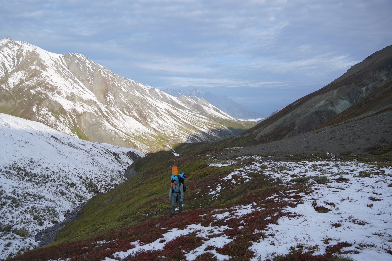 Spoon Valley is visible in the background as Mary walks toward me.
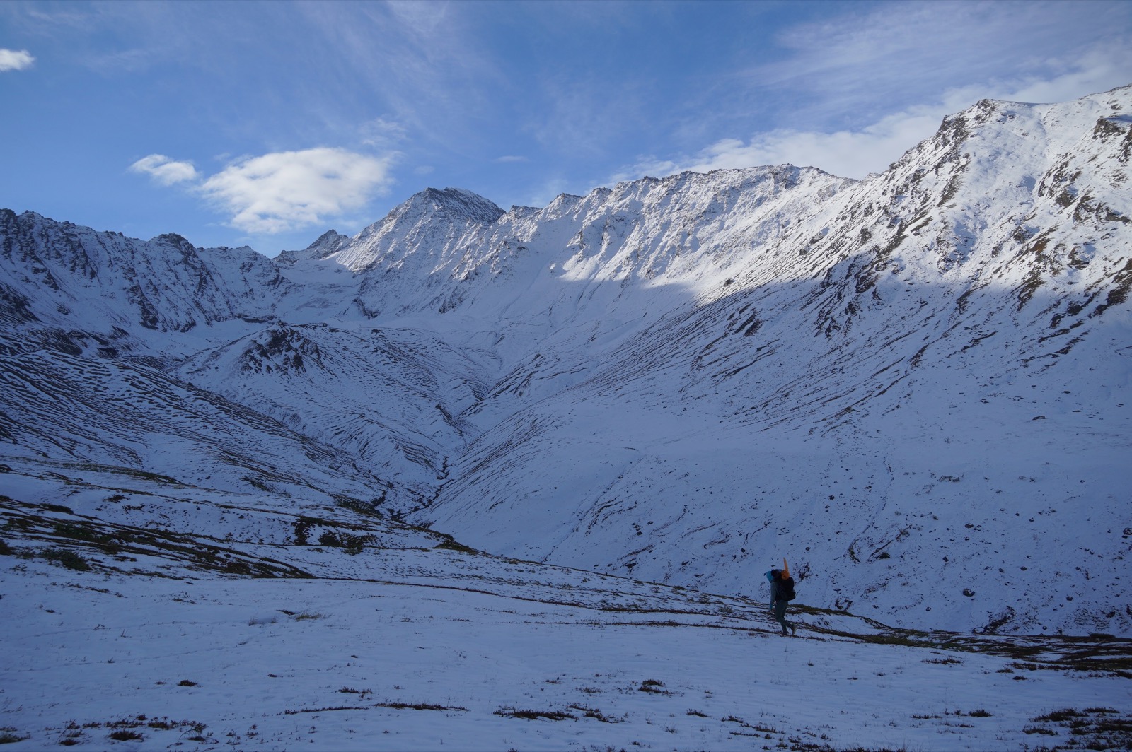 The snowy northeast face of the valley as we ascend.
The final challenge before the pass was walking up a small creek that was steep in places. Fortunately, the creek was largely south-facing, with minimal snow in the creek bed. All the same, we were happy to be hiking up the creek rather than down it.
The snow deepened once we finished the steep part of the climb and leveled out for the final ascent to the pass. Fortunately, there were footprints leading over it. On closer inspection, we discovered they belonged to the same bear as before. His prints must have been a day or two old because they had melted in the sun, leaving us a nice trail to follow.
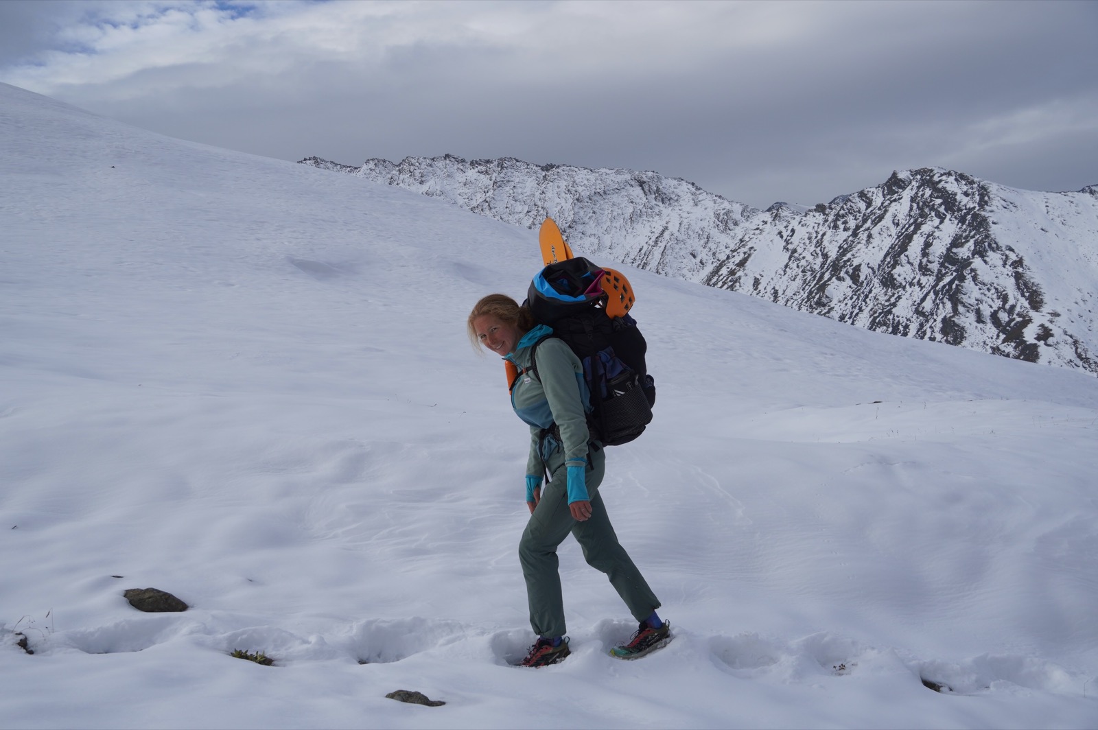 Mary follows the track of our friend the bear.
We ate breakfast and took some photos at the top of the pass.
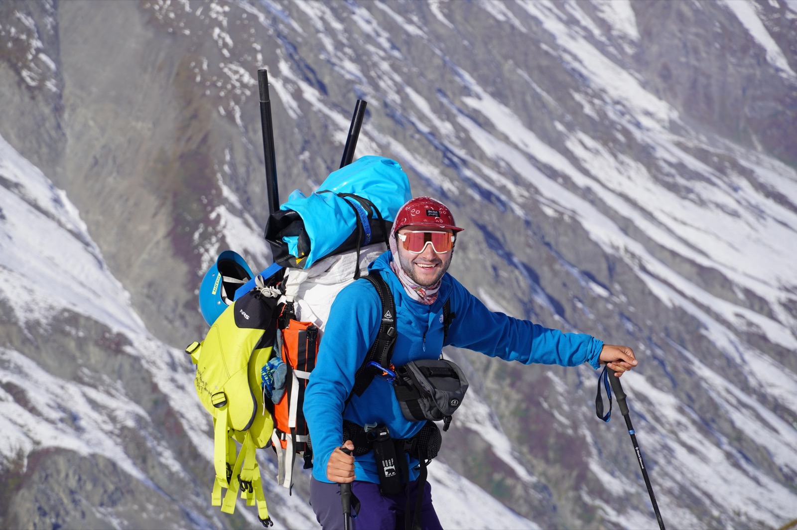 A gentleman always carries the life jackets, as they say.
The first part of the descent from the pass was also pretty straightforward. We walked down a dry ravine until it became a creek, then followed the creek until we found an easy option to walk parallel to it on the left-hand side. Nahla had walked on the right, but there were about six inches of snow on that side today. The final moves to rejoin the creek after our high line to the left were a little steep and dicey, but we were happy with our route.
After rejoining the creek, we ascended about 400 feet to a small knoll that seemed like a lovely campsite, with a view down toward the South Fork of the Matanuska. Looking into the valley, we heard an engine start and saw a small bush plane take flight far below.
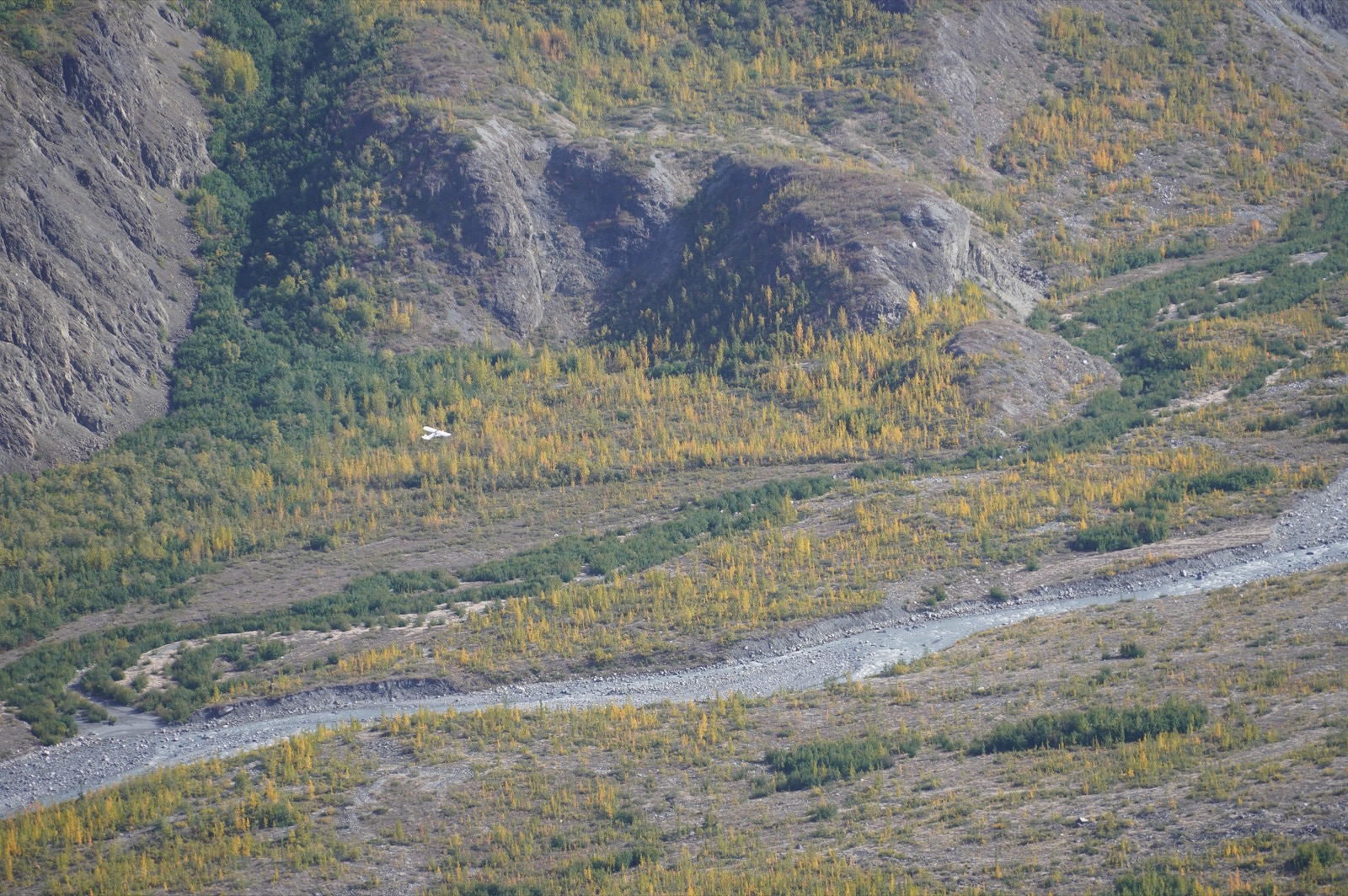 Rarely do I find myself so far above a flying plane.
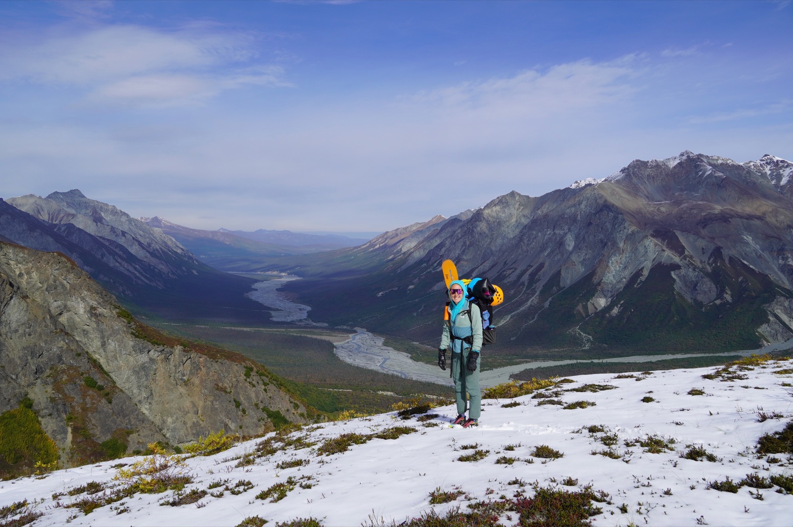 That looks like a river we can paddle!
We ate lunch. I guessed that we would make it to the river by 2:30 p.m. It just wasn’t that far away: about a mile and 1,500 feet of descent. My prediction turned out to be very optimistic. There was enough slippery snow in the main gully that we tried traversing toward greener pastures. However, those green pastures turned out to be the worst bushwhack Mary and I have ever had the good fortune to find ourselves in.
We started the descent shouting “Hey, bear!” every once in a while, in case the big fella we had followed across the pass had decided to park himself on this hillside. However, as the brush grew thicker, we stopped calling, assuming that no self-respecting bear would get himself into such a dense thicket.
At one point, we got close to a small creek, so I thought: What the heck, maybe the creek is a little clearer and we can walk down it. However, the brush and tightly packed trees became especially bad as we approached the creek.
“Maybe we should turn around,” I said to Mary.
“How much farther?” she asked.
“Thirty-nine feet,” I said.
“Let’s go for it,” she said.
So we did, but damned if it didn’t take us 15 minutes to cover those 39 feet. The creek, it turned out, was choked with even tighter trees than the surrounding brush, so we spent another 15 minutes beating our way back to our starting point on a slightly different heading.
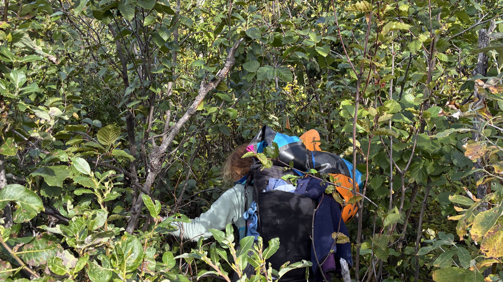 The bushwhack.
Ah, well. We eventually made it to the river at 4 p.m. and celebrated with a snack and some water. From our snack spot, we walked downstream for about 10 minutes until the creek we had followed earlier joined the South Fork. There, we stopped, inflated our packrafts, and prepared to push off.
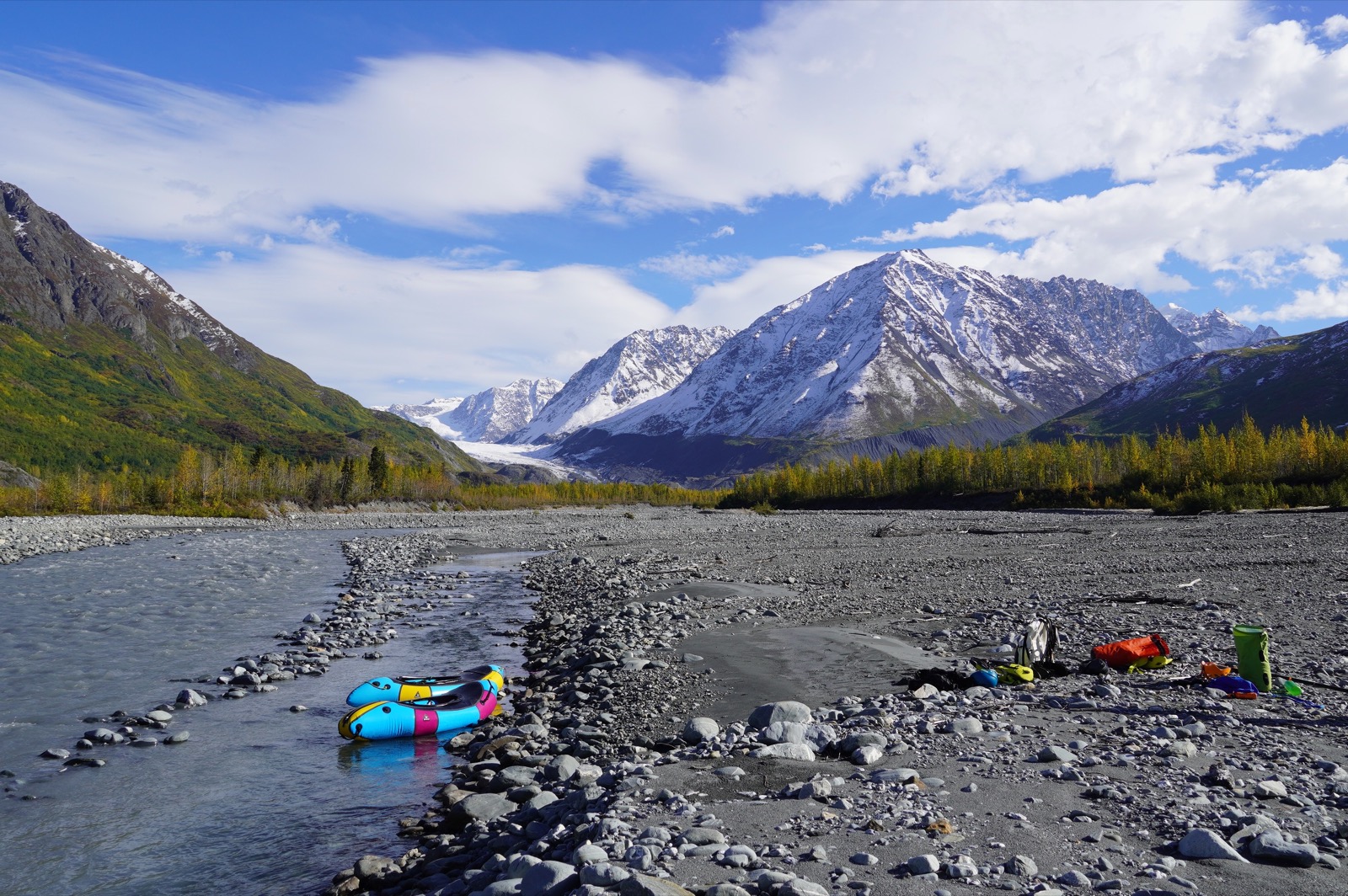 What beautiful contraptions these Alpacka Rafts are!
Of all the challenges this trip posed, the one we had focused on most beforehand was this Class II descent. Neither Mary nor I had ever packrafted. Would we be able to handle a Class II river in a packraft? Even with dry suits, swimming struck both of us as a serious and largely unacceptable outcome. The short float at the start of the trip had bolstered our confidence, and looking at the South Fork encouraged us further. For one thing, there wasn’t much water in the river. It seemed like the biggest risk would be getting stuck on rocks due to low water levels.
We started floating and quickly realized that this was going to work out, as long as we didn’t encounter any unexpected rapids. We had found no reports of any and had not spotted any major features in satellite imagery.
We floated for about an hour and a half, then made camp on an elevated gravel bar in the floodplain.
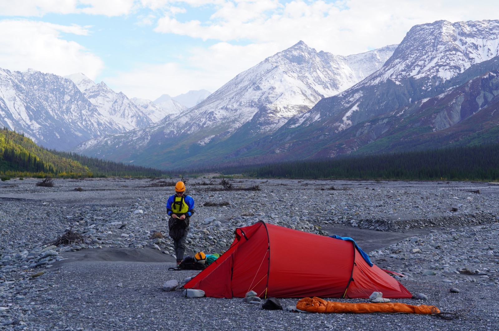 Camp 2.
Our camp caught the last rays of sun, and we ate a very pleasant dinner of ramen and instant potatoes, reveling in the feeling of having overcome so many challenges that, at times, had seemed insurmountable.
Compared with the previous night, the weather was warm, and we seemingly had the whole South Fork of the Matanuska Valley to ourselves.
Day 3
That morning, we had no urgency to get moving. The sun would not hit our spot in the valley until around 9:15. We slept until about 7, and then I recovered the bear can from where we had stashed it the night before and heated water for oats. After a relaxed breakfast, we packed up camp and inflated our boats. Mary had read about packrafts being punctured by bears, so we had deflated ours the night before and stored them in the tent vestibule.
We hit the water at 9 a.m., just as the first light made its way into the valley.
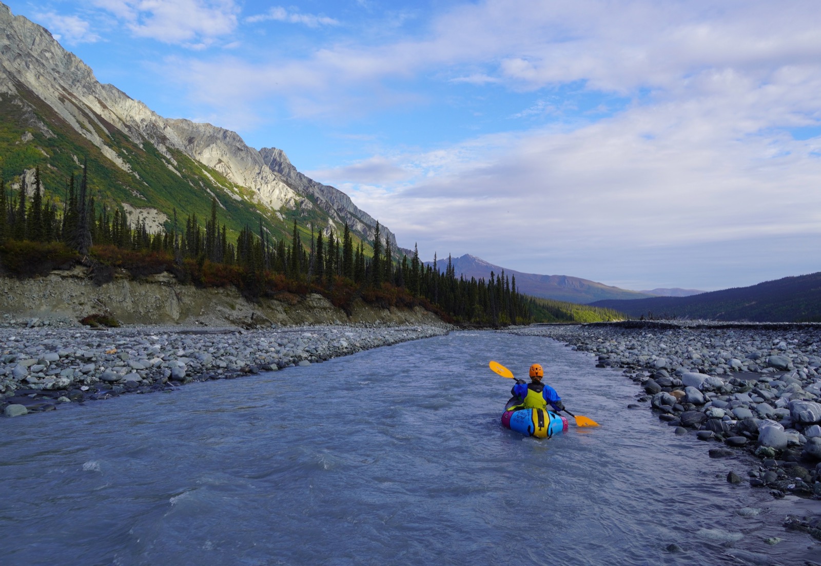
The biggest problem with our packraft setup was that my seat cushion had a leak and slowly deflated over about 15 minutes. This caused two problems. First, my butt was somewhat unprotected when we smashed into rocks, which happened regularly in the low water. During most of the float, a quick paddle poke showed the river to be less than 12 inches deep. Second, I sat lower in the packraft than intended, so when water splashed onto my spray skirt, it formed a small and unpleasant moat around my torso. I tried to mitigate the issue by sitting on my mostly empty backpack. This helped.
Otherwise, the packrafts performed well, and we covered easy miles at a rapid pace. After many painfully slow hiking miles, it felt great to whiz along with only the occasional paddle stroke.
We stopped for a short snack after the river rounded a bend but otherwise floated nearly continuously. It was a beautiful day.
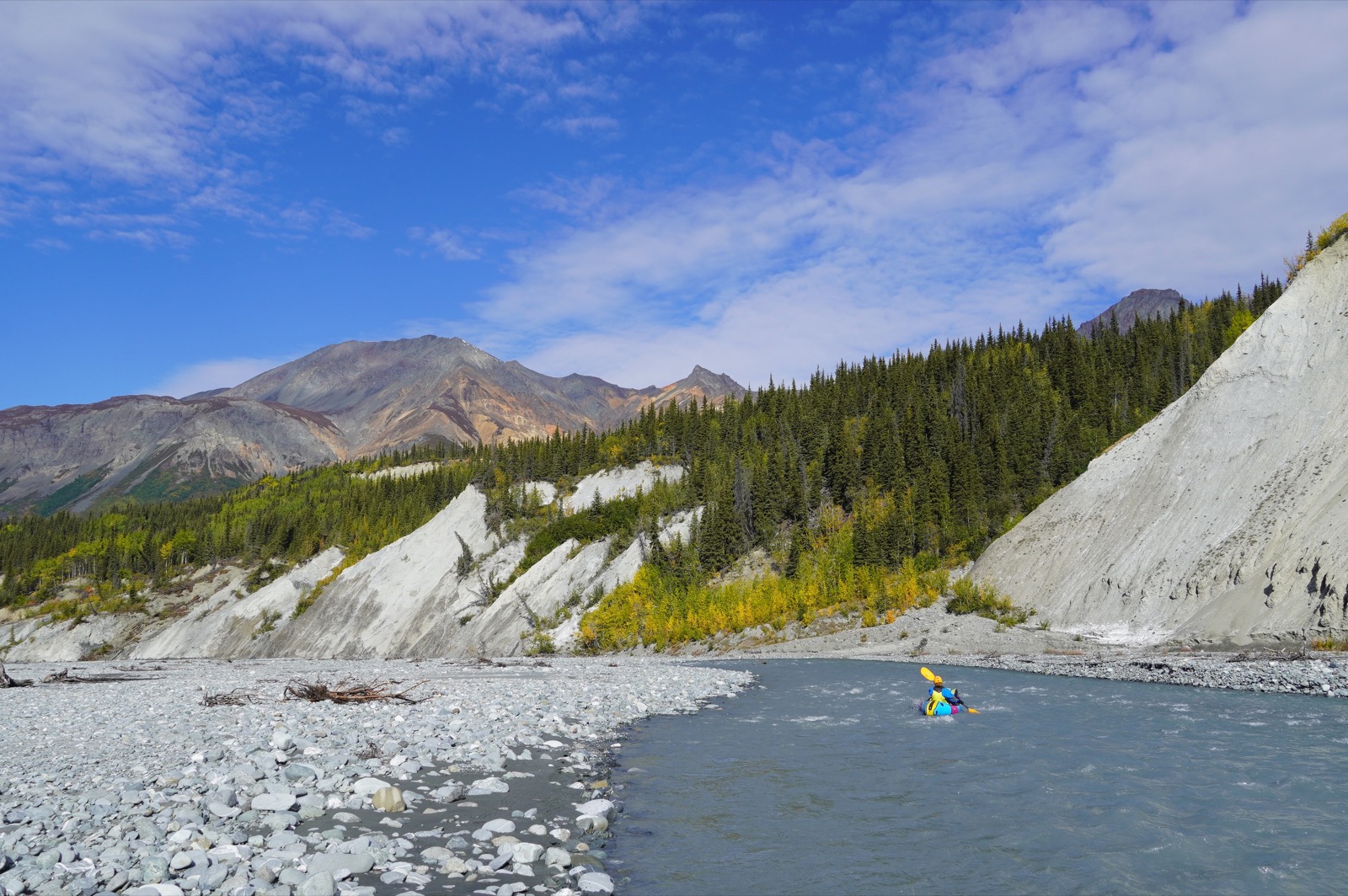
We took out well above the confluence of Caribou Creek and the Matanuska.
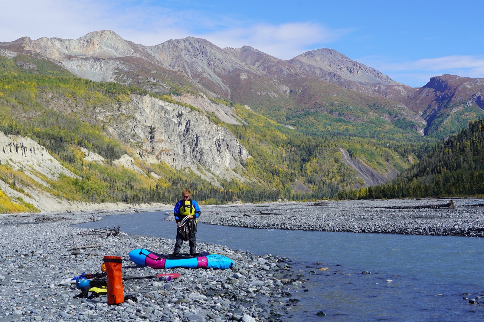 Take out.
A short hike brought us back to the car. We were the only ones in the parking lot. Magical trip!
Notes
- Bring seaweed and packet chicken to add more flavor to the ramen dinner.
- We carried two lighters, which was good because I got one of them wet and it stopped working. Maybe consider the MSR piezoelectric lighter?
- We were limited by rental inventory, but in the future, two Gnarwhals would be ideal for this trip so both boats can hold some gear.
- Storing a backpack between one’s legs or under one’s butt results in the backpack getting totally soaked.
- We should have broken our paddles down more than we did. We each split our paddle into only two sections rather than four. After each bushwhack, I convinced myself there would be no more bushwhacking. I was wrong every time except the last.
Leave a Comment
Your email address will not be published. Required fields are marked *