Desolation Seven Summit Loop
Published:
The context
Desolation Wilderness is a roughly 100 square miles of wilderness area on the Southwest side of Lake Tahoe. Within Desolation lies the Crystal Range whose tallest peak is Pyramid Peak, rising to 9985 feet.
This last winter I spent many days skiing various peaks along the West Shore of Lake Tahoe, and from each of them it is possible to look west into Desolation and pick out some of the larger peaks: Pyramid, Price, Jacks, and Dicks.
This spring, Gus Robinson proposed that we meet up for an August trail run either in the greater Tahoe area or the Eastern Sierra. We entertained various routes but eventually settled on the Seven Summit Loop in Desolation because it was close to Reno, where Gus was working as a summer intern, and closer to Palo Alto than routes in the Eastern Sierra.
We had friends that had previously completed the loop, and who spoke very highly of the views of lake studded Desolation. The route itself circumnavigates Lake Aloha and crosses the summits of Ralston, Pyramid, Agassiz, Price, Jacks, Dicks, and Tallac. While there are various permutations for this route, we followed the route used by the fellow who set the FKT.
With the FKT at about 6 hours and change, we figured the whole loop might take us (Gus, Mary, and myself) about 12 hours. However, to work in some buffer we decided to start running/hiking at 5 AM.
The day
On the morning of August 23rd, Gus, Mary, and I ate a small breakfast at 3:45 AM consisting of hot oats for me and cold soaked oats for Gus and Mary.
We departed our friends’ house at 4:30 AM in South Lake, and drove 23 minutes over Angora ridge and then along the shore of Fallen Leaf Lake to the Lily Lake trailhead where we parked, donned our running shoes, and turned on our headlamps. We walked one complete circuit around the parking lot loop before finding the trailhead and beginning our ascent towards Ralston Peak.
We ascended a steep, vegetated, and buggy Tamarack Trail in the darkness. Color began to appear in the sky and after running a brief segment along the Tahoe Rim Trail (TRT) we began walking again up towards Ralston.
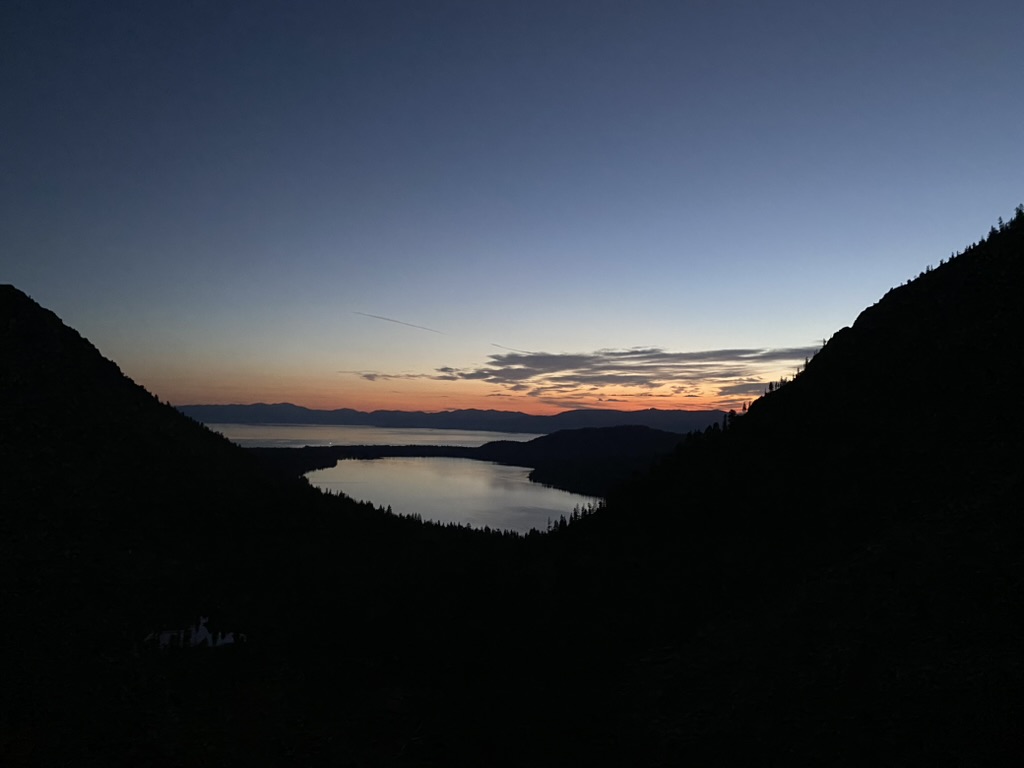 Looking back towards Fallen Leak Lake with Lake Tahoe in the background.
While climbing we discussed a recent NY Times article criticizing SpaceX for paying minimal income tax while receiving government contracts. Mary and I both agreed that SpaceX was being unfairly singled out for taking advantage of a legitimate piece of tax law that allowed companies to count losses in the 2022 tax year against future profits. In our opinion, a better focus of the article would have been on origins of this odd tax code rather than taking a swing at SpaceX. Gus was happy to argue the other side and this back and forth got us to the top of Ralston well entertained. We paused there for a snack and looked out towards Pyramid Lake below us and Pyramid Peak in the distance.
We ran the first 0.3 miles down Ralston but then slowed to a walk once the route left the trail. The 1000 ft descent over 3/4 of a mile down to Pyramid Creek was pretty slow but not especially challenging. At the creek, we filled up about 3L of water capacity per person and ascended a reasonably rocky hillside towards Pyramid Peak. The route climbed up large pieces of rock that were very pleasant to walk on.
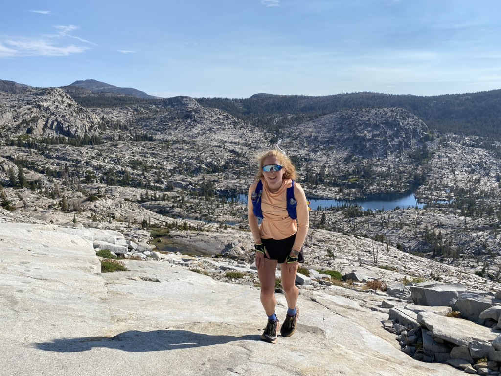 Climbing Pyramid.
We eventually made it to the summit of Pyramid and Mary and I broke out the turkey sandwiches we had packed the previous night while Gus munched on a pretzel snack and looked at our sandwiches somewhat enviously.
From Pyramid, we could see a small unmapped tarn at the lowest point of the upcoming traverse towards Mount Aggasive. That was happy news as all of us realized we had insufficient water to make it to Gilmore Lake which had been our original plan for our next water fill up. The descent down Pyramid Peak was slow and tallused. After descending 150 ft along the ridge, we turned left and descended down an unnamed and reasonably steep gully. I slightly regretted not bringing a climbing helmet to protect against possible rock fall. After emerging from the gully, we had a nice traverse shaded by a steep ridge on our right. We stopped briefly at the tarn to fill up water. My Katadyn Pro water filter was filtering water so slowly I opted to simply pour my unfiltered water into my bladder before refiling the 1L squeeze filter at the tarn.
On the climb up towards Agassiz we discussed various ways we all felt we had grown up since our last big run around the Maroon Bells two years before. Gus had become more considerate and was attempting to speak less harshly; Mary now had her own independent vision for law school that was not simply “do what others are doing”; I had improved at bringing up challenging topics and generally being slightly less agreeable. This topic lasted to the summit of Mt. Agassiz where we had another snack and I gave Gus a bite of my sandwich which he later described as the highlight of his day.
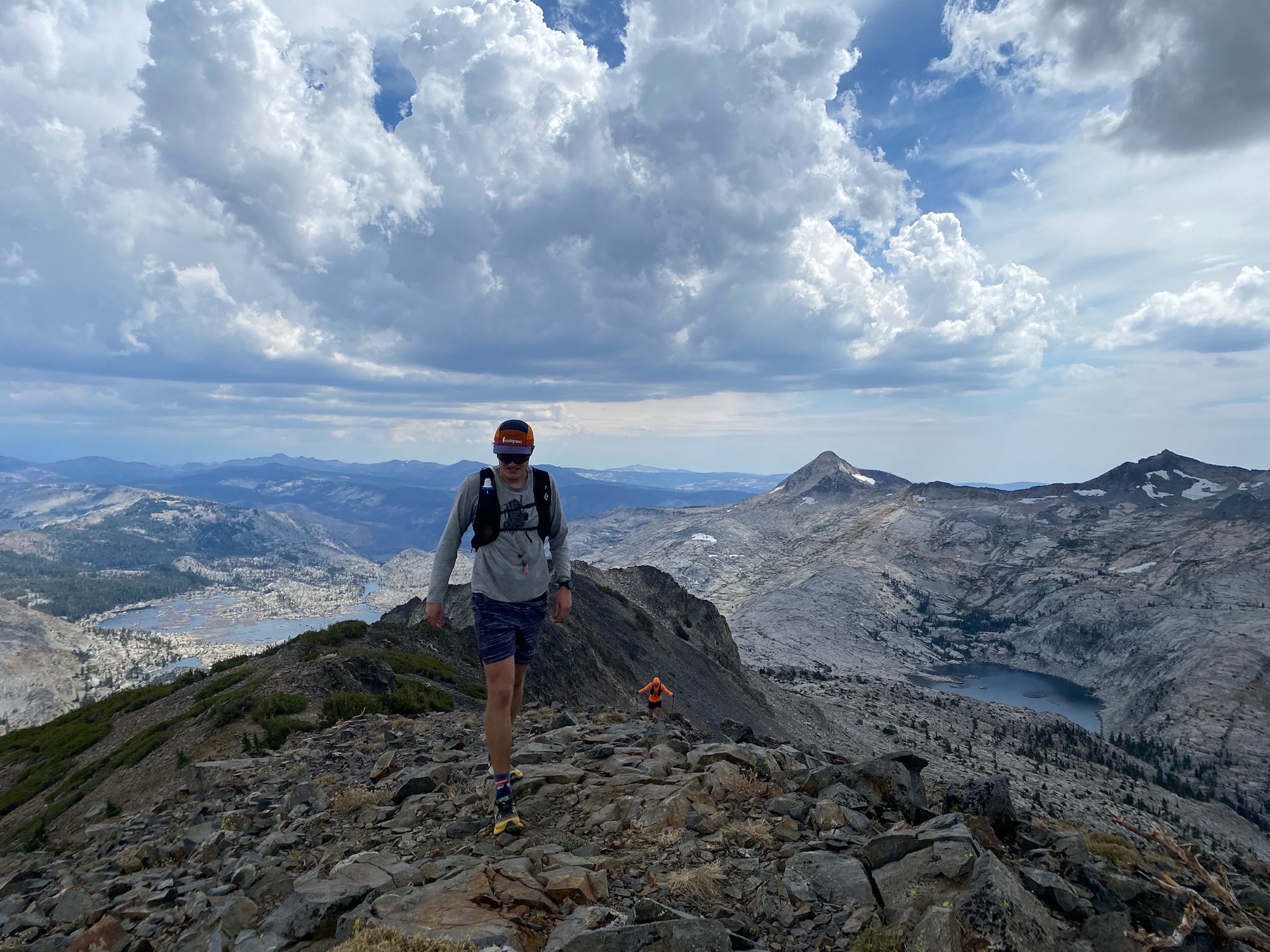
From the summit of Agassiz we had a slow but short traverse over to Mt. Price on the left side of the ridge.
 A slow descent off Mt. Price.
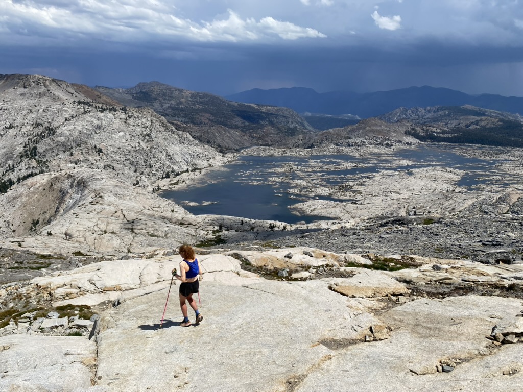
Past Price, we continued on the left side of the ridge until the gradient on the right decreased and we were able to descend down a reasonably steep scree field. We paused at another Tarn on the way down to Mosquito Pass (thank god for all the water!). By this time, the sky had clouded up and it looked like rain might be imminent. Mary was kicking herself because she had opted to not carry a real rain jacket. Nothing to do about that now!
The lower we went the nicer the walking became. On the descent the views of Lake Aloha were beautiful and made me regret not bringing my mirrorless camera.
Mary descends towards Mosquito Pass wondering whether a real rain jacket might have been worth bringing.
We stopped at Mosquito Pass to chat with two women crossing the pass and then for a snack to fortify ourselves on the climb up to Jacks. It was about this point that I realized our elapsed time was going to be more like 14.5 hours rather than the 12 we had predicted that morning. We also realized we were likely to eat basically all our food.
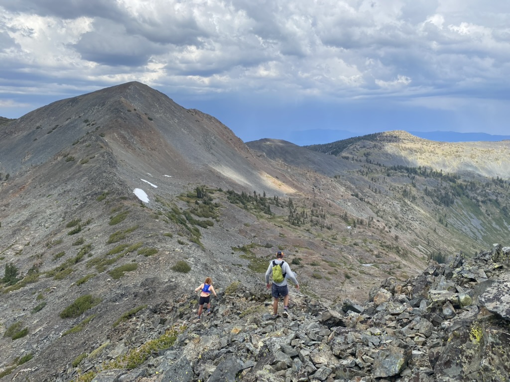
Descending off Jacks with Dicks in the background.
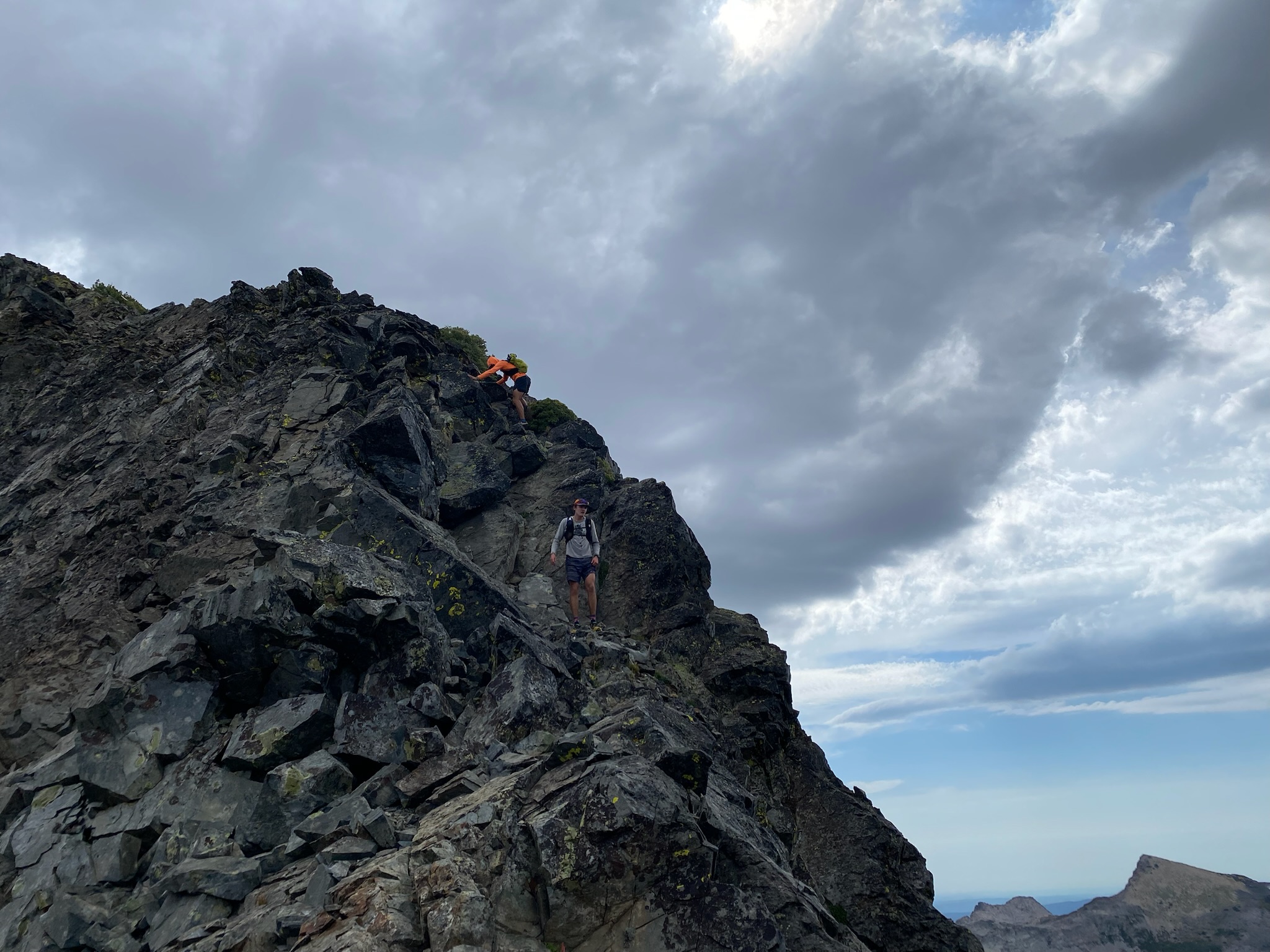
The climb up Jake’s was reasonably straightforward although the subsequent terrain over to Dicks was a little spicy.
Gus dropping Paxton near the summit of Dicks.
The descent down from Dicks was steep and loose. We were happy to make it back on to maintained trails when we rejoined the TRT. On our way to Gilmore Lake, we passed to backpackers who inquired if we were responsible for the rock fall they had heard and if we were okay. We said yes to both points — while Mary was descending Dicks she had kicked a couple big rocks down a gully. We yelled “Rock! Rock!” but fortunately no one was below us.
We filled up water at Gilmore Lake and briefly put our rain jackets on as a couple drops of liquid fell out of the sky. From Gilmore Lake it was perhaps 1.5 hours to the summit of Tallac. After a couple foreboding drops, the rain went away and we enjoyed nice cloudy weather on the climb.
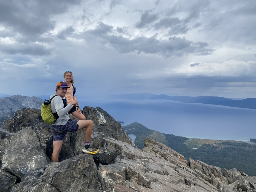
Dry on the summit of Tallac!
After a quick snack, we began our walk downhill and back towards the trailhead. It was a very good feeling to be done with large climbs for the day.
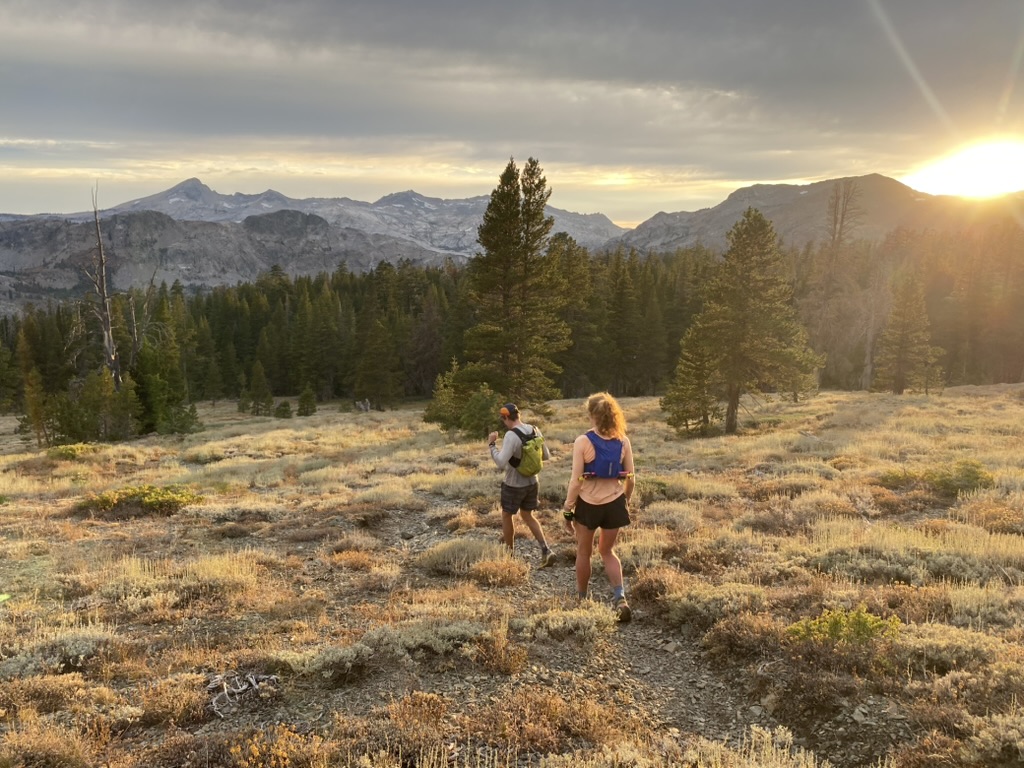
Descending back towards the trailhead as the sun sets.
The trail back was pretty straightforward, although we admired where the FKT runner had managed to get off route. We were very impressed that he managed to get so off route and still finish in six hours.
For us, after an early start at 5 AM or so we barely made it back in the residual light of the evening. We took our shoes off, jumped in the Prius, and after waiting for Gus to execute some half hearted stretch maneuvers, we boogied to a local Mexican restaurant to wrap up a most excellent adventure.
Map
Learnings
- Always bring a rain jacket on a run in the mountains.
- Real food (i.e. Sandwich) much better than bars.
- Off trail miles are SLOW.
- Wow Desolation has many beautiful lakes.
Leave a Comment
Your email address will not be published. Required fields are marked *